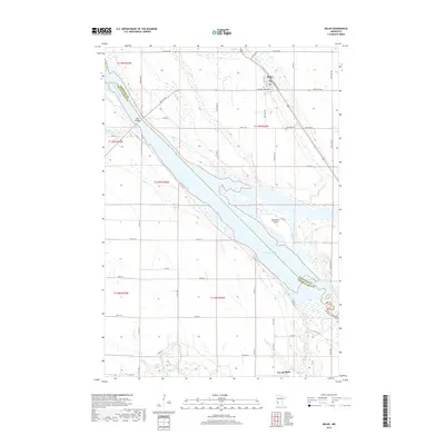
2019 Map of Milan
USGS Topo · Published 2019About this map
Milan serves as the primary settlement in this river-valley landscape, situated just north of where the Minnesota River widens into the expansive Lac Qui Parle. The topography is defined by the significant wetland and river systems that form the boundary between Chippewa and Lac qui Parle counties. To the east of the town, the Kviteseid Cem provides a point of genealogical interest, while the Milan Bridge marks a critical crossing point over the river's path.
Find a feature on this map
42 named features on this map. Tap any name to fly to it.
Don’t see what you’re looking for? This feature index may not catch every label — zoom into the map to look around manually.
Map Details
Editions of this 2019 Milan Map
This is the sole edition of this map. No revisions or reprints were ever made.
Other maps of this area

1953 · Milbank
USGS Topo · 1:250,000

1953 · Watertown
USGS Topo · 1:250,000

1953 · New Ulm
USGS Topo · 1:250,000

1953 · Saint Cloud
USGS Topo · 1:250,000

1957 · Saint Cloud
USGS Topo · 1:250,000

1957 · New Ulm
USGS Topo · 1:250,000

1958 · New Ulm
USGS Topo · 1:250,000

1958 · Milbank
USGS Topo · 1:250,000

1958 · Watertown
USGS Topo · 1:250,000

1958 · Saint Cloud
USGS Topo · 1:250,000