
1946 Map of Milan
USGS Topo · Published 1946About this map
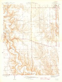
Laughery Creek carves a deep, winding path through the center of this Ripley County landscape, its dramatic oxbows such as Henderson Bend defining the local geography. Much of the western edge is occupied by the Versailles State Recreational Area, where a prominent Fire Tower overlooks the wooded slopes. The upland plains are dotted with the essential structures of rural mid-century Indiana life, including the Stringtown Sch and Smith Sch, alongside several active congregations at Zion Ch and Pleasant Hill Ch. The map provides significant detail for genealogists, identifying numerous family-named burial grounds like Marble Corner Cem and Blair Cem. Small hubs like Milan and Elrod serve as the primary anchors for this agricultural and timbered region, connected by a network of roads that follow the high ridges between the creek valleys.
Find a feature on this map
24 named features on this map. Tap any name to fly to it.
Don’t see what you’re looking for? This feature index may not catch every label — zoom into the map to look around manually.
Map Details
Editions of this 1946 Milan Map
2 editions found
Other maps of this area

1946 · Versailles
USGS Topo · 1:24,000

1946 · Pierceville
USGS Topo · 1:24,000

1946 · Osgood
USGS Topo · 1:24,000

1953 · Cincinnati
USGS Topo · 1:250,000

1956 · Louisville
USGS Topo · 1:250,000

1957 · Cincinnati
USGS Topo · 1:250,000

1958 · Sunman
USGS Topo · 1:24,000

1958 · Dillsboro
USGS Topo · 1:24,000
1959 · Rexville
USGS Topo · 1:24,000
1959 · Bear Branch
USGS Topo · 1:24,000