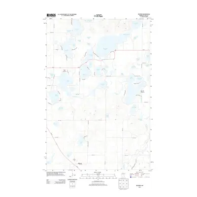
2013 Map of Mildred
USGS Topo · Published 2013About this map
Mildred serves as the primary settlement node in this 2013 survey of Cass County, situated near the southern edge where MN-371 and local roads like 12th ST SW converge. The landscape is defined by an intricate network of glacial lakes and waterways, with Big Portage Lake and Rice Portage Lake dominating the central and eastern portions of the quadrangle. These water bodies, along with the meandering Pine River, have long dictated the region's development as a destination for seasonal recreation and timber.
Find a feature on this map
82 named features on this map. Tap any name to fly to it.
Don’t see what you’re looking for? This feature index may not catch every label — zoom into the map to look around manually.
Map Details
Editions of this 2013 Mildred Map
This is the sole edition of this map. No revisions or reprints were ever made.
Other maps of this area

1919 · Leader
USGS Topo · 1:62,500

1953 · Brainerd
USGS Topo · 1:250,000

1957 · Brainerd
USGS Topo · 1:250,000

1958 · Brainerd
USGS Topo · 1:250,000

1959 · Pine River
USGS Topo · 1:24,000

1959 · Jenkins
USGS Topo · 1:24,000

1965 · Brainerd
USGS Topo · 1:250,000

1970 · Backus
USGS Topo · 1:24,000

1970 · Hackensack
USGS Topo · 1:24,000
1970 · Bungo Creek
USGS Topo · 1:24,000