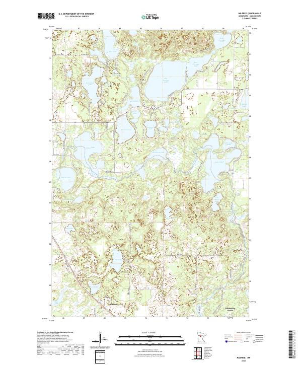
2022 Map of Mildred
USGS Topo · Published 2022About this map
Mildred and the shoreline community of Chickamaw Beach anchor this portion of Cass County, defined by a dense network of glacial lakes and wetlands. The landscape is dominated by large water bodies such as Deep Portage Lake, Big Portage Lake, and Lake Hattie, which are connected by a system of roads and trails including Deep Portage Dr NW and the Pine River Trl. The Pine River winds through the central terrain, passing through Brockway Lake and Lindsey Lake as it moves across the quadrangle. For those researching local history or genealogy, the Pine River Cem is located south of Mildred, providing a specific point of interest for family history. The map also captures the distribution of seasonal and permanent homes clustered around lakes like Horseshoe Lake and Rainy Lake, reflecting the region's long-standing character as a residential and recreational lake district.
Find a feature on this map
102 named features on this map. Tap any name to fly to it.
Don’t see what you’re looking for? This feature index may not catch every label — zoom into the map to look around manually.
Map Details
Editions of this 2022 Mildred Map
This is the sole edition of this map. No revisions or reprints were ever made.
Other maps of this area

1919 · Leader
USGS Topo · 1:62,500

1953 · Brainerd
USGS Topo · 1:250,000

1957 · Brainerd
USGS Topo · 1:250,000

1958 · Brainerd
USGS Topo · 1:250,000

1959 · Pine River
USGS Topo · 1:24,000

1959 · Jenkins
USGS Topo · 1:24,000

1965 · Brainerd
USGS Topo · 1:250,000

1970 · Backus
USGS Topo · 1:24,000

1970 · Hackensack
USGS Topo · 1:24,000
1970 · Bungo Creek
USGS Topo · 1:24,000