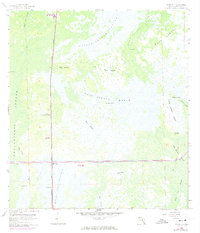
1959 Map of Miles City
USGS Topo · Published 1974About this map
Miles City and its surrounding wetlands are defined by the convergence of industrial transport and natural strands in this mid-century Collier County survey. The landscape is dominated by vast hydrologic systems, including the Fakahatchee Strand and the Okaloacoochee Slough, which dictate the placement of human infrastructure. The Seaboard Coast Line runs north-to-south, intersecting the prominent Everglades Parkway (Alligator Alley) near the Miles City Lookout Tower.
Find a feature on this map
30 named features on this map. Tap any name to fly to it.
Don’t see what you’re looking for? This feature index may not catch every label — zoom into the map to look around manually.
Map Details
Editions of this 1959 Miles City Map
4 editions found
Other maps of this area

1956 · West Palm Beach
USGS Topo · 1:250,000

1957 · West Palm Beach
USGS Topo · 1:250,000

1958 · West Palm Beach
USGS Topo · 1:250,000

1958 · Catherine Island
USGS Topo · 1:24,000

1958 · Sunniland
USGS Topo · 1:24,000

1958 · Immokalee SW
USGS Topo · 1:24,000

1959 · Miles City
USGS Topo · 1:24,000

1959 · Deep Lake
USGS Topo · 1:24,000

1959 · Deep Lake SW
USGS Topo · 1:24,000
1962 · Catherine Island
USGS Topo · 1:24,000