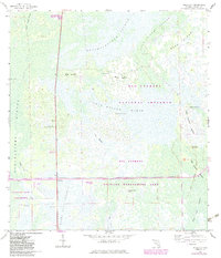
1959 Map of Miles City
USGS Topo · Published 1983About this map
Miles City Prairie and the surrounding wetland strands of the Florida Everglades dominate this landscape during a period of transition in the mid-20th century. The small settlement of Miles City sits near the intersection of major access routes, including the Everglades Parkway (Alligator Alley) Toll Road. The map documents a blend of early human history and modern infrastructure, with several Indian Mounds rising above the wet prairies alongside the Miles City Lookout Tower and a Landing Strip.
Find a feature on this map
29 named features on this map. Tap any name to fly to it.
Don’t see what you’re looking for? This feature index may not catch every label — zoom into the map to look around manually.
Map Details
Editions of this 1959 Miles City Map
4 editions found
Other maps of this area

1956 · West Palm Beach
USGS Topo · 1:250,000

1957 · West Palm Beach
USGS Topo · 1:250,000

1958 · West Palm Beach
USGS Topo · 1:250,000

1958 · Catherine Island
USGS Topo · 1:24,000

1958 · Sunniland
USGS Topo · 1:24,000

1958 · Immokalee SW
USGS Topo · 1:24,000

1959 · Miles City
USGS Topo · 1:24,000

1959 · Deep Lake
USGS Topo · 1:24,000

1959 · Deep Lake SW
USGS Topo · 1:24,000
1962 · Catherine Island
USGS Topo · 1:24,000