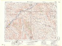
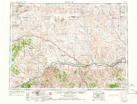
1957 Map of Miles City
USGS Topo · Published 1957About this map
Miles City sits as the regional hub at the confluence of the Yellowstone River and Tongue River, serving as a critical junction for the Northern Pacific RR and the Chicago Milwaukee St Paul and Pacific RR. The landscape in the mid-1950s was defined by a wide-reaching network of rural schools and family-named landmarks, reflecting a settled ranching economy before the consolidation of rural districts. Notable examples include the Jordan School, Lame Jones School, and the Crawford Keltner Ranch.
Find a feature on this map
136 named features on this map. Tap any name to fly to it.
Don’t see what you’re looking for? This feature index may not catch every label — zoom into the map to look around manually.
Map Details
Editions of this 1957 Miles City Map
This is the sole edition of this map. No revisions or reprints were ever made.
Other maps of this area

1909 · Glendive
USGS Topo · 1:250,000
1935 · Buffalo
USGS Topo · 1:125,000

1953 · Miles City
USGS Topo · 1:250,000
1953 · Dickinson
USGS Topo · 1:250,000
1953 · Watford City
USGS Topo · 1:250,000
1954 · Hardin
USGS Topo · 1:250,000
1954 · Lemmon
USGS Topo · 1:250,000
1954 · Jordan
USGS Topo · 1:250,000
1954 · Ekalaka
USGS Topo · 1:250,000
1954 · Forsyth
USGS Topo · 1:250,000