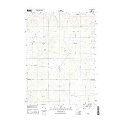
2015 Map of Miles
USGS Topo · Published 2015About this map
Miles serves as the central hub for this portion of Jackson and Clinton Counties, situated at the intersection of a sprawling rural road network. The landscape is defined by the winding paths of the Elk River and its branches, such as N Br Elk River and S Copper Cr, which carve through the Iowa countryside. This 2015 survey reveals a significant concentration of small, dispersed burial sites that offer deep genealogical potential, including family-named locations like the Horst Farm Cem, Watts Farm Cem, and Schroeder Farm Cem. The map further documents small settlements such as Van Buren and Sterling, while tracing larger water bodies like the Maquoketa River in the north. The proximity of numerous historic grounds, such as Old Van Buren Cem and Vernon Prairie Cem, suggests a long-established agricultural community where land ownership and family heritage are closely tied to the creek-fed valleys.
Find a feature on this map
46 named features on this map. Tap any name to fly to it.
Don’t see what you’re looking for? This feature index may not catch every label — zoom into the map to look around manually.
Map Details
Editions of this 2015 Miles Map
This is the sole edition of this map. No revisions or reprints were ever made.
Other maps of this area

1891 · Clinton
USGS Topo · 1:62,500

1892 · Goose Lake
USGS Topo · 1:62,500

1892 · Savanna
USGS Topo · 1:62,500

1894 · Goose Lake
USGS Topo · 1:62,500

1894 · Clinton
USGS Topo · 1:62,500

1899 · Clinton
USGS Topo · 1:125,000

1935 · Miles
USGS Topo · 1:62,500

1941 · Miles
USGS Topo · 1:62,500

1952 · Clinton
USGS Topo · 1:62,500

1952 · Savanna
USGS Topo · 1:62,500