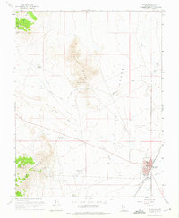
1958 Map of Milford
USGS Topo · Published 1976About this map
Milford stands as a vital rail and ranching hub at the edge of the Escalante Desert during the late 1950s. The town's grid is anchored by the Union Pacific railroad and features essential local landmarks like the High School, Fairground, and Cemetary. To the west, the landscape rises into the Rocky Range and Star Range, where a legacy of extraction is visible through numerous workings such as the Montreal Mine, Old Hickory Mine, and the Harrington-Hickory Mine.
Find a feature on this map
41 named features on this map. Tap any name to fly to it.
Don’t see what you’re looking for? This feature index may not catch every label — zoom into the map to look around manually.
Map Details
Editions of this 1958 Milford Map
3 editions found
Other maps of this area

1885 · Beaver
USGS Topo · 1:250,000

1953 · Milford Flat
USGS Topo · 1:24,000

1953 · Cave Canyon
USGS Topo · 1:24,000

1953 · Richfield
USGS Topo · 1:250,000

1958 · Richfield
USGS Topo · 1:250,000

1958 · Milford
USGS Topo · 1:62,500

1958 · Milford
USGS Topo · 1:24,000

1958 · Adamsville
USGS Topo · 1:62,500

1958 · Ranch Canyon
USGS Topo · 1:24,000

1960 · Beaver Lake Mts.
USGS Topo · 1:62,500