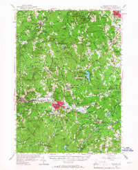
1953 Map of Milford
USGS Topo · Published 1967About this map
The Souhegan River and Piscataquog River systems anchor this study of south-central New Hampshire, centering on the manufacturing hub of Milford and the surrounding mill towns. In the early 1950s, the Boston and Maine railroad still navigated these valleys, connecting Wilton, Amherst, and Ponemah to the industrial centers of Nashua and Manchester. A significant portion of the interior is occupied by the U S Military Reservation Air Force Bombing Range, which sits amidst a landscape of named family hills such as Joe English Hill and McCollom Hill. Educational and recreational landmarks are well-represented, from St Anselms College in the northeast to the specialized High Mowing Sch in the south. The map documents numerous small ponds and state-managed lands, including the Curtiss Dogwood State Res and Silver Lake State Park, illustrating the region's balance of industry, academic life, and conservation during this post-war era.
Find a feature on this map
111 named features on this map. Tap any name to fly to it.
Don’t see what you’re looking for? This feature index may not catch every label — zoom into the map to look around manually.
Map Details
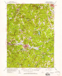
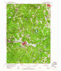
Editions of this 1953 Milford Map
3 editions found
Other maps of this area

1886 · Lowell
USGS Topo · 1:62,500

1887 · Fitchburg
USGS Topo · 1:62,500

1889 · Fitchburg
USGS Topo · 1:62,500

1893 · Lowell
USGS Topo · 1:62,500

1893 · Fitchburg
USGS Topo · 1:62,500

1893 · Groton
USGS Topo · 1:62,500

1900 · Peterboro
USGS Topo · 1:62,500

1905 · Manchester
USGS Topo · 1:62,500

1906 · Milford
USGS Topo · 1:62,500

1918 · Lowell
USGS Topo · 1:62,500