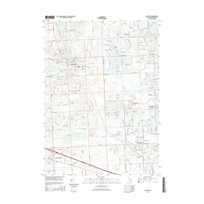
2014 Map of Milford
USGS Topo · Published 2014About this map
Milford and Wixom anchor this landscape of the Detroit metropolitan fringe, where the Huron River and various glacial lakes dictate the pattern of 21st-century suburban development. Significant local history is preserved in sites like Oak Grove Cem and Saint Mary's Cem, while the industrial presence of General Motors Rd and Wixom Trl highlights the area's automotive heritage. The map details a dense network of water bodies, from Hubbell Pond to the expansive Wolverine Lake and Lake Sherwood, which have historically driven the residential character of these Oakland County communities. Transportation corridors like Grand River Ave and Pontiac Trl reveal the enduring importance of historic through-ways in connecting older village centers like New Hudson and Glengary with the expanding reach of the surrounding metropolitan region.
Find a feature on this map
69 named features on this map. Tap any name to fly to it.
Don’t see what you’re looking for? This feature index may not catch every label — zoom into the map to look around manually.
Map Details
Editions of this 2014 Milford Map
This is the sole edition of this map. No revisions or reprints were ever made.
Other maps of this area

1902 · South Lyon
USGS Topo · 1:62,500

1904 · Ann Arbor
USGS Topo · 1:125,000

1905 · Wayne
USGS Topo · 1:62,500

1906 · South Lyon
USGS Topo · 1:62,500

1907 · Pontiac
USGS Topo · 1:62,500

1908 · Ann Arbor
USGS Topo · 1:125,000

1909 · Milford
USGS Topo · 1:62,500

1912 · Wayne
USGS Topo · 1:62,500

1936 · Wixom
USGS Topo · 1:31,680

1936 · Highland
USGS Topo · 1:31,680
Featured Places
- Novi, MI
- Commerce Charter Township, MI
- White Lake Charter Township, MI
- Lyon Charter Township, MI
- Highland Charter Township, MI