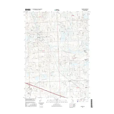
2017 Map of Milford
USGS Topo · Published 2017About this map
The Huron River corridor and its surrounding lakes form the backbone of this Oakland County landscape, characterized by a complex network of waterways and modern suburban development. The village of Milford serves as a central hub, where Hubbell Pond and several long-standing burial grounds like Oak Grove Cem and Saint Mary's Cem reflect the area's deep-rooted community history. Further south, the city of Wixom and the community of New Hudson are connected by major transit arteries such as Pontiac Trl and Grand River Ave.
Find a feature on this map
56 named features on this map. Tap any name to fly to it.
Don’t see what you’re looking for? This feature index may not catch every label — zoom into the map to look around manually.
Map Details
Editions of this 2017 Milford Map
This is the sole edition of this map. No revisions or reprints were ever made.
Other maps of this area

1902 · South Lyon
USGS Topo · 1:62,500

1904 · Ann Arbor
USGS Topo · 1:125,000

1905 · Wayne
USGS Topo · 1:62,500

1906 · South Lyon
USGS Topo · 1:62,500

1907 · Pontiac
USGS Topo · 1:62,500

1908 · Ann Arbor
USGS Topo · 1:125,000

1909 · Milford
USGS Topo · 1:62,500

1912 · Wayne
USGS Topo · 1:62,500

1936 · Wixom
USGS Topo · 1:31,680

1936 · Highland
USGS Topo · 1:31,680
Featured Places
- Novi, MI
- Commerce Charter Township, MI
- White Lake Charter Township, MI
- Lyon Charter Township, MI
- Highland Charter Township, MI