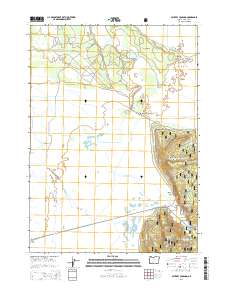
2014 Map of Military Crossing
USGS Topo · Published 2014About this map
Military Crossing marks a key focal point in this portion of Klamath County, where the historic Military Rd intersects the high desert and forest transition of the Winema National Forest. The landscape is defined by the wandering path of the Williamson River and its tributaries, including Big Springs Creek, which flow through a region of distinct volcanic and fluvial features. Notable landmarks such as The Peninsula, Windmill Point, and Rocky Point suggest a topography of ancient basalt flows and lake margins, while the presence of the Kittredge Canal indicates the region's managed water systems. To the southeast, the terrain rises toward Wildhorse Ridge and Skellock Draw, where industrial activity is noted at the Skellock Pit. This 2014 survey documents the modern road network, including Silver Lake Rd and Three Creeks Rd, as they navigate this sparsely populated timber and ranching country.
Find a feature on this map
20 named features on this map. Tap any name to fly to it.
Don’t see what you’re looking for? This feature index may not catch every label — zoom into the map to look around manually.
Map Details
Editions of this 2014 Military Crossing Map
This is the sole edition of this map. No revisions or reprints were ever made.
Other maps of this area

1889 · Klamath
USGS Topo · 1:250,000

1894 · Klamath
USGS Topo · 1:250,000

1935 · Chemult
USGS Topo · 1:96,000

1941 · Chemult
USGS Topo · 1:125,000

1955 · Crescent
USGS Topo · 1:250,000

1955 · Klamath Falls
USGS Topo · 1:250,000

1957 · Crescent
USGS Topo · 1:250,000

1957 · Klamath Marsh
USGS Topo · 1:62,500

1957 · Lenz
USGS Topo · 1:62,500

1958 · Crescent
USGS Topo · 1:250,000