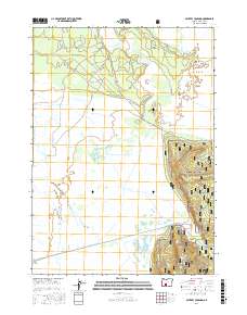
2017 Map of Military Crossing
USGS Topo · Published 2017About this map
Klamath Marsh National Wildlife Refuge dominates this section of Klamath County, where the expansive wetlands of the Klamath Marsh meet the higher elevations of the Winema National Forest. The landscape is defined by the winding course of the Williamson River and its interaction with early irrigation and transport infrastructure. The namesake Military Crossing serves as a key landmark over the river, situated near the Kittredge Canal. To the east, the terrain rises sharply toward Wildhorse Ridge, creating a distinct vertical boundary between the riparian basin and the forested uplands. Evidence of land management and resource extraction is visible in features like the Skellock Pit and various forest development roads. This area reflects a long-standing balance between natural preservation and the utilitarian needs of the southern Oregon interior, from water management for agriculture to the protection of critical avian habitats.
Find a feature on this map
23 named features on this map. Tap any name to fly to it.
Don’t see what you’re looking for? This feature index may not catch every label — zoom into the map to look around manually.
Map Details
Editions of this 2017 Military Crossing Map
This is the sole edition of this map. No revisions or reprints were ever made.
Other maps of this area

1889 · Klamath
USGS Topo · 1:250,000

1894 · Klamath
USGS Topo · 1:250,000

1935 · Chemult
USGS Topo · 1:96,000

1941 · Chemult
USGS Topo · 1:125,000

1955 · Crescent
USGS Topo · 1:250,000

1955 · Klamath Falls
USGS Topo · 1:250,000

1957 · Crescent
USGS Topo · 1:250,000

1957 · Klamath Marsh
USGS Topo · 1:62,500

1957 · Lenz
USGS Topo · 1:62,500

1958 · Crescent
USGS Topo · 1:250,000