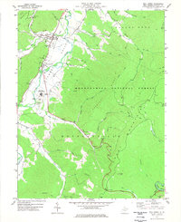
1977 Map of Mill Creek
USGS Topo · Published 1977About this map
Huttonsville and Mill Creek anchor the developed corridor along the Tygart Valley River, where the valley floor transitions sharply into the high timberlands of the Monongahela National Forest. In the mid-1970s, this area reflects a mix of institutional presence and resource extraction, notably featuring the Huttonsville Correctional Center and several strip mines located near White Top and Cromer Top. The valley landscape is marked by civic and religious infrastructure, including the Tygart Valley High Sch, Jerusalem Ch, and a Filtration Plant supporting the riverside communities. Rising above the river, the terrain climbs toward Rich Mountain and Cheat Mountain, while dozens of smaller drainages like Becky Creek and Mc Call Run carve through the forested ridges. This survey details the complex network of mountain roads and jeep trails that service the high-elevation gaps and summits like Hutton Knob.
Find a feature on this map
56 named features on this map. Tap any name to fly to it.
Don’t see what you’re looking for? This feature index may not catch every label — zoom into the map to look around manually.
Map Details
Editions of this 1977 Mill Creek Map
2 editions found
Other maps of this area

1889 · Beverly
USGS Topo · 1:125,000

1892 · Beverly
USGS Topo · 1:125,000

1893 · Buckhannon
USGS Topo · 1:125,000

1896 · Buckhannon
USGS Topo · 1:125,000

1897 · Buckhannon
USGS Topo · 1:125,000

1909 · Elkins
USGS Topo · 1:62,500

1912 · Sago
USGS Topo · 1:48,000

1913 · Pickens
USGS Topo · 1:48,000

1914 · Sago
USGS Topo · 1:62,500

1915 · Pickens
USGS Topo · 1:62,500