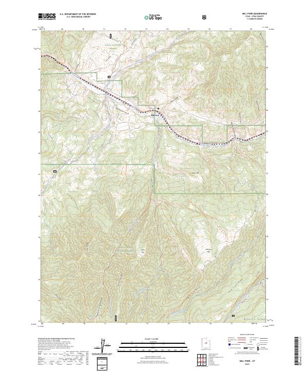
2023 Map of Mill Fork
USGS Topo · Published 2023About this map
Mill Fork and its small mountain cemetery sit at the convergence of rugged canyons where Soldier Creek meets the broader drainage of Spanish Fork Canyon. This map details a high-elevation landscape defined by the intersection of the Uinta National Forest and Manti-La Sal National Forest. The topography is dominated by massive divides such as Clear Creek Ridge and Mill Fork Ridge, which separate the various forks and hollows that feed the larger canyon system. A network of primitive trails and forest roads, including the Sheep Creek Connector Trail and Skyline Drive, provide access to points like Mountain Lion Spring and Terry Flat. The drainage patterns here, particularly around Dairy Fork and Water Hollow, illustrate the complex hydrology of the Wasatch Range transition into the central plateau regions.
Find a feature on this map
41 named features on this map. Tap any name to fly to it.
Don’t see what you’re looking for? This feature index may not catch every label — zoom into the map to look around manually.
Map Details
Editions of this 2023 Mill Fork Map
This is the sole edition of this map. No revisions or reprints were ever made.
Other maps of this area

1885 · Salt Lake
USGS Topo · 1:250,000

1885 · Manti
USGS Topo · 1:250,000

1895 · Manti
USGS Topo · 1:250,000

1907 · Strawberry Valley
USGS Topo · 1:125,000

1909 · Strawberry Valley
USGS Topo · 1:125,000

1939 · Soldier Summit
USGS Topo · 1:62,500

1942 · Soldier Summit
USGS Topo · 1:62,500

1954 · Salt Lake City
USGS Topo · 1:250,000

1956 · Price
USGS Topo · 1:250,000

1958 · Salt Lake City
USGS Topo · 1:250,000