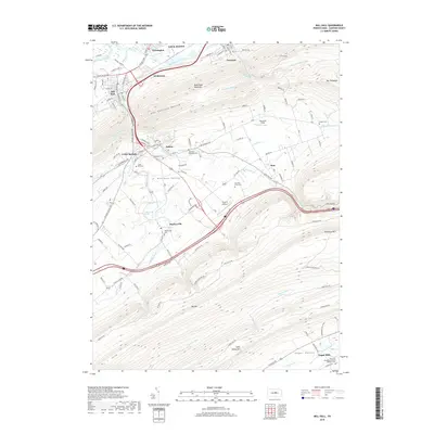
2019 Map of Mill Hall
USGS Topo · Published 2019About this map
Bald Eagle Mountain and Riansares Mtn dominate this landscape, framing the agricultural expanse of Nittany Valley and Sugar Valley. The topography dictates the settlement patterns, with towns like Mill Hall and Lock Haven positioned along the valley floor where Bald Eagle Creek and Fishing Creek converge. The rural character of the region is evident in the numerous family and community burial grounds, including Methodist Episcopal Cem and East End Amish Cem. Industrial and transport footprints appear through features like Axe Factory Hollow and the Poverty Airport. In the southeast corner, the small community of Logan Mills sits near the Saint Paul Evangelical United Brethren Cem, representing the enduring rural hamlets that define the central Pennsylvania interior.
Find a feature on this map
114 named features on this map. Tap any name to fly to it.
Don’t see what you’re looking for? This feature index may not catch every label — zoom into the map to look around manually.
Map Details
Editions of this 2019 Mill Hall Map
This is the sole edition of this map. No revisions or reprints were ever made.
Other maps of this area

1921 · Howard
USGS Topo · 1:48,000

1921 · Lock Haven
USGS Topo · 1:62,500

1923 · Howard
USGS Topo · 1:62,500

1923 · Lock Haven
USGS Topo · 1:62,500

1924 · Centre Hall
USGS Topo · 1:62,500

1929 · Centre Hall
USGS Topo · 1:62,500

1937 · Millheim
USGS Topo · 1:48,000

1941 · Millheim
USGS Topo · 1:62,500

1943 · Lewistown
USGS Topo · 1:125,000

1944 · Lock Haven
USGS Topo · 1:62,500