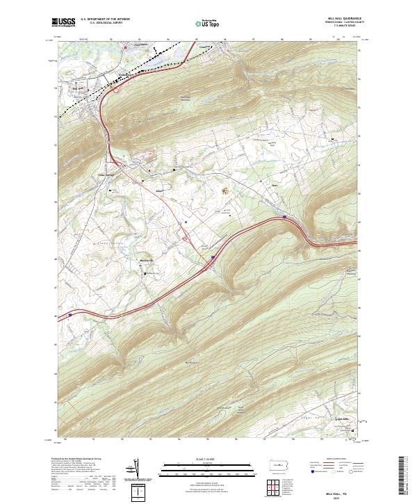
2023 Map of Mill Hall
USGS Topo · Published 2023About this map
Mill Hall and Flemington anchor the northern reaches of this landscape, where the historical footprint of the Pennsylvania Canal remains visible alongside Bald Eagle Creek. The terrain is defined by the heavy ridges of Bald Eagle Mountain and Big Mountain, which create the distinct agricultural corridor of Nittany Valley. This topography shaped early settlement patterns, concentrating towns like Salona and Mackeyville in the lowlands while leaving the heights to the Bald Eagle State Forest.
Find a feature on this map
121 named features on this map. Tap any name to fly to it.
Don’t see what you’re looking for? This feature index may not catch every label — zoom into the map to look around manually.
Map Details
Editions of this 2023 Mill Hall Map
This is the sole edition of this map. No revisions or reprints were ever made.
Other maps of this area

1921 · Howard
USGS Topo · 1:48,000

1921 · Lock Haven
USGS Topo · 1:62,500

1923 · Howard
USGS Topo · 1:62,500

1923 · Lock Haven
USGS Topo · 1:62,500

1924 · Centre Hall
USGS Topo · 1:62,500

1929 · Centre Hall
USGS Topo · 1:62,500

1937 · Millheim
USGS Topo · 1:48,000

1941 · Millheim
USGS Topo · 1:62,500

1943 · Lewistown
USGS Topo · 1:125,000

1944 · Lock Haven
USGS Topo · 1:62,500