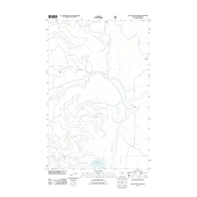
2011 Map of Mill Pocket Creek
USGS Topo · Published 2011About this map
The Little Bitterroot River winds through this Sanders County landscape, providing a central drainage for numerous mountain creeks and irrigation systems. The map details a specialized water management network including the Camas A Canal and Alder Creek Ditch, which redirect water across the terrain to support local land use. Elevated landmarks such as Sullivan Hill and Lozeau Flats overlook the valleys, while the Mill Pocket basin sits at the confluence of several small drainages.
Find a feature on this map
26 named features on this map. Tap any name to fly to it.
Don’t see what you’re looking for? This feature index may not catch every label — zoom into the map to look around manually.
Map Details
Editions of this 2011 Mill Pocket Creek Map
This is the sole edition of this map. No revisions or reprints were ever made.
Other maps of this area

1956 · Wallace
USGS Topo · 1:250,000

1960 · Wallace
USGS Topo · 1:250,000

1964 · Mill Pocket Creek
USGS Topo · 1:24,000
1964 · Kofford Ridge
USGS Topo · 1:24,000

1964 · Coney Peak
USGS Topo · 1:24,000

1964 · Hubbart Reservoir
USGS Topo · 1:24,000

1964 · Murr Peak
USGS Topo · 1:24,000

1964 · Lonepine
USGS Topo · 1:24,000
1964 · Bassoo Peak
USGS Topo · 1:24,000
1964 · Niarada
USGS Topo · 1:24,000