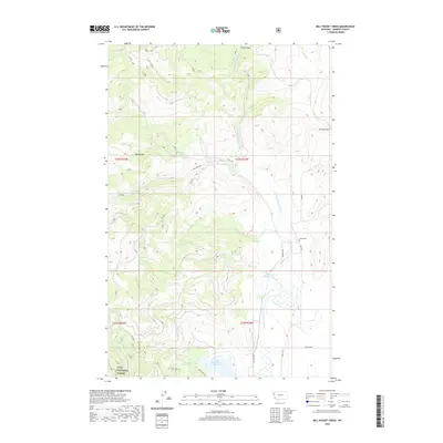
2020 Map of Mill Pocket Creek
USGS Topo · Published 2020About this map
Lolo National Forest encompasses the western portion of this Sanders County landscape, where the terrain transitions from the high ground of Sullivan Hill and Mill Pocket down toward the Little Bitterroot River valley. The map documents an intricate water management system essential to this region, featuring the Upper Dry Fork Reservoir, Camas A Canal, and the Alder Cr Ditch. These man-made features alongside Dry Fork Cr and Mill Cr illustrate the historical reliance on irrigation and water storage in the Montana interior.
Find a feature on this map
24 named features on this map. Tap any name to fly to it.
Don’t see what you’re looking for? This feature index may not catch every label — zoom into the map to look around manually.
Map Details
Editions of this 2020 Mill Pocket Creek Map
This is the sole edition of this map. No revisions or reprints were ever made.
Other maps of this area

1956 · Wallace
USGS Topo · 1:250,000

1960 · Wallace
USGS Topo · 1:250,000

1964 · Mill Pocket Creek
USGS Topo · 1:24,000
1964 · Kofford Ridge
USGS Topo · 1:24,000

1964 · Coney Peak
USGS Topo · 1:24,000

1964 · Hubbart Reservoir
USGS Topo · 1:24,000

1964 · Murr Peak
USGS Topo · 1:24,000

1964 · Lonepine
USGS Topo · 1:24,000
1964 · Bassoo Peak
USGS Topo · 1:24,000
1964 · Niarada
USGS Topo · 1:24,000