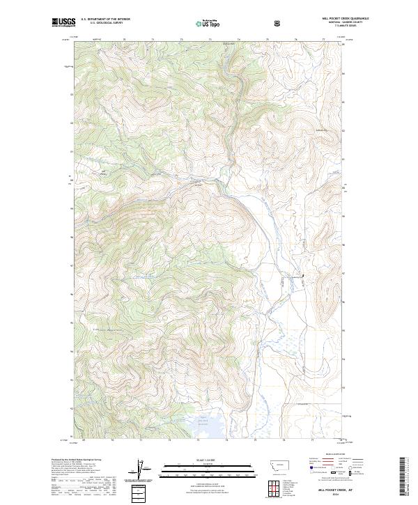
2024 Map of Mill Pocket Creek
USGS Topo · Published 2024About this map
The Little Bitterroot River winds through the eastern portion of this Montana landscape, where the high peaks of the Cabinet Mountains define the western horizon. This terrain transitions from the steep drainage of Mill Pocket Creek and Bassoo Creek down to the irrigation-focused valley floors. The presence of the McKay Cem and Upper Dry Fork Reservoir suggests a long-standing balance between rural settlement and the necessity of water management in this part of Sanders County. Water infrastructure is a defining characteristic of the local economy here, evidenced by the Camas A Canal, Alder Creek Ditch, and several named service roads like Mill Creek Rd and Far West Rd that provide access to the foothills and high basins of the Mill Pocket area.
Find a feature on this map
28 named features on this map. Tap any name to fly to it.
Don’t see what you’re looking for? This feature index may not catch every label — zoom into the map to look around manually.
Map Details
Editions of this 2024 Mill Pocket Creek Map
This is the sole edition of this map. No revisions or reprints were ever made.
Other maps of this area

1956 · Wallace
USGS Topo · 1:250,000

1960 · Wallace
USGS Topo · 1:250,000

1964 · Mill Pocket Creek
USGS Topo · 1:24,000
1964 · Kofford Ridge
USGS Topo · 1:24,000

1964 · Coney Peak
USGS Topo · 1:24,000

1964 · Hubbart Reservoir
USGS Topo · 1:24,000

1964 · Murr Peak
USGS Topo · 1:24,000

1964 · Lonepine
USGS Topo · 1:24,000
1964 · Bassoo Peak
USGS Topo · 1:24,000
1964 · Niarada
USGS Topo · 1:24,000