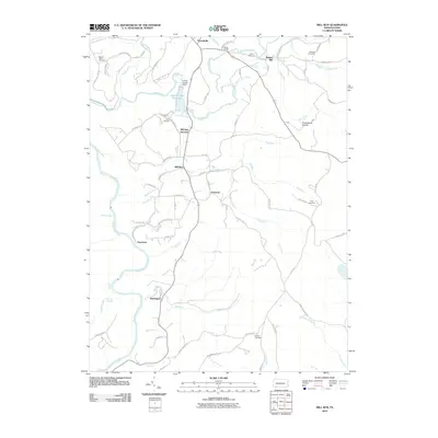
2010 Map of Mill Run
USGS Topo · Published 2010About this map
Indian Creek Reservoir and the Indian Creek Dam dominate the northern landscape of this region, which is characterized by a network of steep hollows and winding mountain streams. The Youghiogheny River carves through the southwestern corner, creating a rugged riparian corridor marked by Sugar Run Falls and Jonathan Run Falls. Small rural settlements like Normalville, Rogers Mill, and Mill Run are connected by a web of local roads, including Maple Summit Rd and Turkey Foot Rd. Genealogists will find significant value in the distribution of family-named landmarks and resting places such as Mount Tabor Cemetery, Imel Cemetery, and Sands Cemetery. The infrastructure of the era is evidenced by the White Bridge and the namesake rail connections at Mill Run Junction, reflecting a community deeply integrated with its hydraulic and wooded surroundings.
Find a feature on this map
85 named features on this map. Tap any name to fly to it.
Don’t see what you’re looking for? This feature index may not catch every label — zoom into the map to look around manually.
Map Details
Editions of this 2010 Mill Run Map
This is the sole edition of this map. No revisions or reprints were ever made.
Other maps of this area

1900 · Uniontown
USGS Topo · 1:62,500

1902 · Connellsville
USGS Topo · 1:62,500

1922 · Confluence
USGS Topo · 1:62,500

1922 · Donegal
USGS Topo · 1:62,500

1931 · Connellsville
USGS Topo · 1:62,500

1931 · Uniontown
USGS Topo · 1:62,500

1931 · Confluence
USGS Topo · 1:62,500

1933 · Confluence
USGS Topo · 1:62,500

1935 · Donegal
USGS Topo · 1:62,500

1936 · Connellsville
USGS Topo · 1:62,500
Featured Places
- Lower Turkeyfoot Township, PA
- Dunbar Township, PA
- Springfield Township, PA
- Normalville, Springfield Township
- Fairmont, Springfield Township