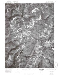
1977 Map of Mill Run
USGS Topo · Published 1979About this map
Youghiogheny River winds through the southwestern corner of this orthophotoquad, defining a sharp, high-relief landscape that transitions into the agricultural and wooded highlands of Fayette County. The imagery, captured in the late 1970s, reveals a rural economy shaped by both water resources and surface activity. The settlement of Mill Run sits centrally, supported by nearby Mill Run Reservoir and the winding course of Indian Creek. To the north, the small community of Normalville and the site of Rogers Mill mark the historical footprint of early industry and highland farming. This aerial perspective provides a unique look at the patchwork of cleared fields and dense forest cover before modern development altered the woodland boundaries, including the isolated waters of Cranberry Glade Lake in the southeast.
Find a feature on this map
7 named features on this map. Tap any name to fly to it.
Don’t see what you’re looking for? This feature index may not catch every label — zoom into the map to look around manually.
Map Details
Editions of this 1977 Mill Run Map
This is the sole edition of this map. No revisions or reprints were ever made.
Other maps of this area

1900 · Uniontown
USGS Topo · 1:62,500

1902 · Connellsville
USGS Topo · 1:62,500

1922 · Confluence
USGS Topo · 1:62,500

1922 · Donegal
USGS Topo · 1:62,500

1931 · Connellsville
USGS Topo · 1:62,500

1931 · Uniontown
USGS Topo · 1:62,500

1931 · Confluence
USGS Topo · 1:62,500

1933 · Confluence
USGS Topo · 1:62,500

1935 · Donegal
USGS Topo · 1:62,500

1936 · Connellsville
USGS Topo · 1:62,500
Featured Places
- Springfield Township, PA
- Lower Turkeyfoot Township, PA
- Dunbar Township, PA
- Stewart Township, PA
- Rogers Mill, Springfield Township