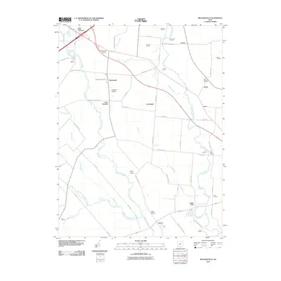
2010 Map of Milledgeville
USGS Topo · Published 2010About this map
Milledgeville and its surrounding rural townships are defined by a complex network of agricultural drainage and family landmarks in this early 21st-century documentation. The village center, anchored by the Milledgeville Post Office, serves as a hub for scattered communities like South Plymouth, Hagler, and Jasper Mills. The landscape is etched with historical burial grounds that reflect the area's genealogical roots, including the Jefferson-Jasper Township Cemetery and the Milledgeville-Plymouth Cemetery. Natural and man-made watercourses dictate the terrain, with Rattlesnake Creek and the West Branch Rattlesnake Creek winding through fields alongside engineered features like the Missouri Ditch. Transportation and local infrastructure are represented by the Creamer Airpark and numerous country roads such as Miami Trace Rd NW, illustrating the persistent agrarian character of this Fayette County region.
Find a feature on this map
58 named features on this map. Tap any name to fly to it.
Don’t see what you’re looking for? This feature index may not catch every label — zoom into the map to look around manually.
Map Details
Editions of this 2010 Milledgeville Map
This is the sole edition of this map. No revisions or reprints were ever made.
Other maps of this area

1906 · Mt Sterling
USGS Topo · 1:62,500

1916 · Octa
USGS Topo · 1:62,500

1917 · Greenfield
USGS Topo · 1:62,500

1917 · Sabina
USGS Topo · 1:62,500

1943 · Sabina
USGS Topo · 1:62,500

1944 · Greenfield
USGS Topo · 1:62,500

1944 · Octa
USGS Topo · 1:62,500

1947 · Columbus
USGS Topo · 1:250,000
1960 · New Martinsburg
USGS Topo · 1:24,000

1961 · Columbus
USGS Topo · 1:250,000