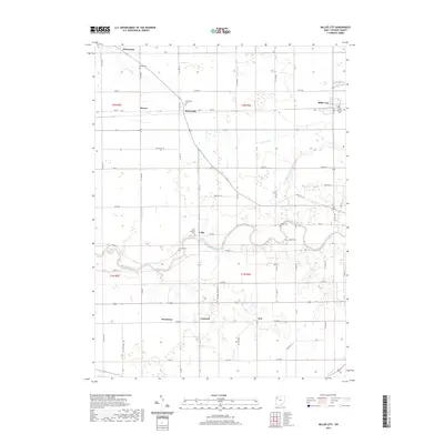
2019 Map of Miller City
USGS Topo · Published 2019About this map
The Blanchard River meanders across this rural Putnam County landscape, defining the character of the region with its winding course through Palmer Township. Numerous small agricultural settlements and crossroads anchor the survey, including Miller City, Kieferville, and Cuba. The local history of these communities is preserved in family and church burial grounds such as Saint Nicholas Cem, Kieferville Cem, and Wing Cem, which provide essential points of reference for genealogical research. The map illustrates a developed network of county and township roads that follow the section lines of the Public Land Survey System, reflecting the organized rural planning of Northwest Ohio. Smaller hamlets like Dorninton, Croswell, and Avis appear along the southern edge, while the Miller City Cutoff and various drainage features like Duck Run and Bear Cr highlight the managed hydrology of this productive farmland.
Find a feature on this map
72 named features on this map. Tap any name to fly to it.
Don’t see what you’re looking for? This feature index may not catch every label — zoom into the map to look around manually.
Map Details
Editions of this 2019 Miller City Map
This is the sole edition of this map. No revisions or reprints were ever made.
Other maps of this area

1906 · Columbus Grove
USGS Topo · 1:62,500

1908 · Columbus Grove
USGS Topo · 1:62,500

1908 · Ottawa
USGS Topo · 1:62,500

1909 · Continental
USGS Topo · 1:62,500

1911 · Delphos
USGS Topo · 1:62,500

1944 · Delphos
USGS Topo · 1:62,500

1953 · Fort Wayne
USGS Topo · 1:250,000

1953 · Muncie
USGS Topo · 1:250,000

1956 · Muncie
USGS Topo · 1:250,000

1956 · Fort Wayne
USGS Topo · 1:250,000