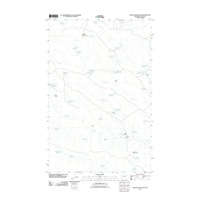
2011 Map of Miller Coulee East
USGS Topo · Published 2011About this map
Gideon Ranch and Blanchard Cabin sit within an arid Montana landscape defined by complex water management and seasonal drainages. The area is dominated by the winding paths of Sage Hen Creek, Coyote Creek, and Beaver Creek, which feed a vast network of small, specialized reservoirs. These features, including Thunderhead Pit Reservoir, Tiney Pit Reservoir, and Big Fork Reservoir, illustrate the critical infrastructure required for ranching and resource management in Valley County. The land is further marked by the geographic depression of Miller Coulee, while various dams like the Sage Hen Reservoir Number 2 Dam and Big Forks Dam regulate the flow across this high-plains environment.
Find a feature on this map
43 named features on this map. Tap any name to fly to it.
Don’t see what you’re looking for? This feature index may not catch every label — zoom into the map to look around manually.
Map Details
Editions of this 2011 Miller Coulee East Map
This is the sole edition of this map. No revisions or reprints were ever made.
Other maps of this area

1943 · Glasgow
USGS Topo · 1:125,000

1954 · Jordan
USGS Topo · 1:250,000

1954 · Glasgow
USGS Topo · 1:250,000

1956 · Jordan
USGS Topo · 1:250,000

1957 · Glasgow
USGS Topo · 1:250,000

1958 · Glasgow
USGS Topo · 1:250,000

1958 · Jordan
USGS Topo · 1:250,000

1958 · Engstrom Ranch
USGS Topo · 1:24,000

1958 · Miller Coulee
USGS Topo · 1:62,500

1958 · Collins Ranch
USGS Topo · 1:62,500