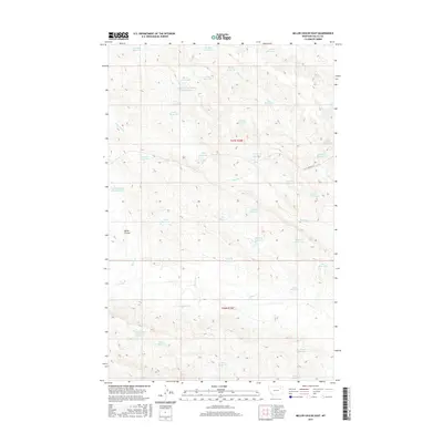
2017 Map of Miller Coulee East
USGS Topo · Published 2017About this map
Miller Coulee serves as the primary drainage feature through this arid landscape in Valley County, where water management is the defining human footprint. The terrain is densely dotted with numerous small, specialized basins such as Thunderhead Pit Reservoir, Sage Hen Reservoir Number Two, and Big Fork Reservoir. These reservoirs, alongside features like Tiney Pit Reservoir and Deep Cut Reservoir, reveal an extensive network of livestock or agricultural water catchments necessary for sustaining life in this part of Montana. Travel across the section lines is represented by routes like Little Beaver Rd, which connects scattered water sources including Sunfish Reservoir and McIntyre Reservoir. The naming conventions, featuring labels like Crappie Reservoir and Seagull Reservoir, reflect the local importance of these small water bodies in an otherwise dry prairie environment.
Find a feature on this map
42 named features on this map. Tap any name to fly to it.
Don’t see what you’re looking for? This feature index may not catch every label — zoom into the map to look around manually.
Map Details
Editions of this 2017 Miller Coulee East Map
This is the sole edition of this map. No revisions or reprints were ever made.
Other maps of this area

1943 · Glasgow
USGS Topo · 1:125,000

1954 · Jordan
USGS Topo · 1:250,000

1954 · Glasgow
USGS Topo · 1:250,000

1956 · Jordan
USGS Topo · 1:250,000

1957 · Glasgow
USGS Topo · 1:250,000

1958 · Glasgow
USGS Topo · 1:250,000

1958 · Jordan
USGS Topo · 1:250,000

1958 · Engstrom Ranch
USGS Topo · 1:24,000

1958 · Miller Coulee
USGS Topo · 1:62,500

1958 · Collins Ranch
USGS Topo · 1:62,500