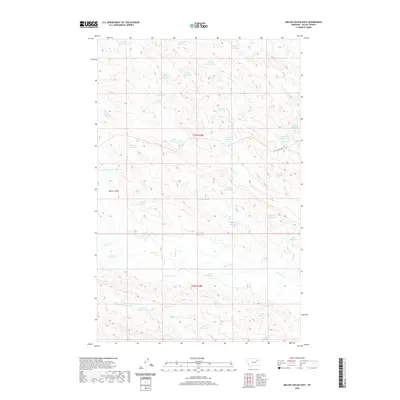
2020 Map of Miller Coulee East
USGS Topo · Published 2020About this map
Miller Coulee serves as the central geographic axis for this portion of Valley County, where the landscape is defined by an extensive network of drainage basins and water management. Unlike many neighboring regions, this area is characterized by a high density of small, named reservoirs, suggesting a highly managed hydraulic environment for cattle or agricultural use in the Montana plains. Named features such as Dicks Reservoir, Wilson Reservoir, and McIntyre Reservoir are situated along the ephemeral flows of Sage Hen Cr and Coyote Cr. The presence of the Little Beaver Rd and the Thunderhead Pit Reservoir indicates localized infrastructure supporting transport and excavation. The map's detail provides a specialized record of land use within the t27n r38e and t26n r38e townships, documenting the distribution of water sources across the high prairie.
Find a feature on this map
40 named features on this map. Tap any name to fly to it.
Don’t see what you’re looking for? This feature index may not catch every label — zoom into the map to look around manually.
Map Details
Editions of this 2020 Miller Coulee East Map
This is the sole edition of this map. No revisions or reprints were ever made.
Other maps of this area

1943 · Glasgow
USGS Topo · 1:125,000

1954 · Jordan
USGS Topo · 1:250,000

1954 · Glasgow
USGS Topo · 1:250,000

1956 · Jordan
USGS Topo · 1:250,000

1957 · Glasgow
USGS Topo · 1:250,000

1958 · Glasgow
USGS Topo · 1:250,000

1958 · Jordan
USGS Topo · 1:250,000

1958 · Engstrom Ranch
USGS Topo · 1:24,000

1958 · Miller Coulee
USGS Topo · 1:62,500

1958 · Collins Ranch
USGS Topo · 1:62,500