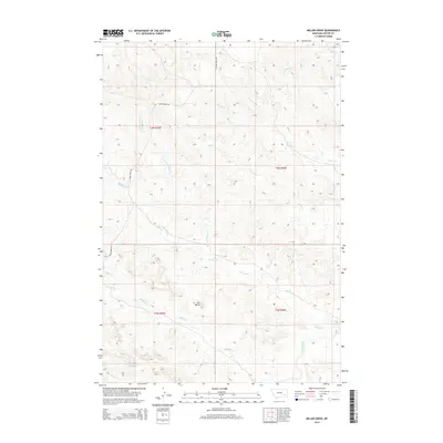
2014 Map of Miller Creek
USGS Topo · Published 2014About this map
Twin Buttes rises as a prominent landmark in the southern reaches of this Custer County landscape, marking the high ground between the drainage systems of Miller Cr and Sixmile Cr. The terrain is defined by a complex network of seasonal and perennial watercourses that flow toward the southeast, eventually meeting the Tongue River as it cuts across the corner of the survey. These waterways, including Horse Cr and Miles Cr, have carved deep coulees and draws through the plains, creating the distinctive topography of eastern Montana.
Find a feature on this map
17 named features on this map. Tap any name to fly to it.
Don’t see what you’re looking for? This feature index may not catch every label — zoom into the map to look around manually.
Map Details
Editions of this 2014 Miller Creek Map
This is the sole edition of this map. No revisions or reprints were ever made.
Other maps of this area

1953 · Miles City
USGS Topo · 1:250,000

1954 · Hardin
USGS Topo · 1:250,000

1954 · Ekalaka
USGS Topo · 1:250,000

1954 · Forsyth
USGS Topo · 1:250,000

1956 · Ekalaka
USGS Topo · 1:250,000

1957 · Miles City
USGS Topo · 1:250,000

1957 · Hardin
USGS Topo · 1:250,000

1957 · Forsyth
USGS Topo · 1:250,000

1958 · Miles City
USGS Topo · 1:250,000

1958 · Ekalaka
USGS Topo · 1:250,000