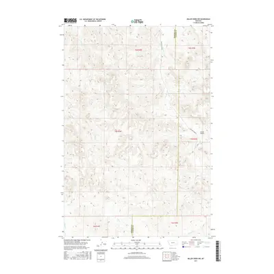
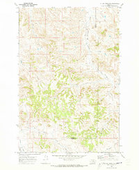
2017 Map of Miller Creek NW
USGS Topo · Published 2017About this map
The divide between Rosebud and Custer counties cuts through this high plains landscape, where water and topography dictate the movement of early travel routes. The drainage of Graveyard Cr serves as a primary geographic anchor, accompanied by the rural pathway of Graveyard Creek Rd which follows the contours of the valley. To the east, the terrain is shaped by Horton Hollow, a significant topographical feature amidst the numerous draws. The hydrology of the area is defined by a series of intermittent streams including Iron Jaw Cr, Buffalo Cr, and Coal Cr, which flow through the dissected plateaus of this ranching country. This 2017 survey reflects the enduring spatial patterns of Eastern Montana, where section lines and county boundaries remain the primary human imprints on a landscape dominated by its drainage network and named coulees.
Find a feature on this map
16 named features on this map. Tap any name to fly to it.
Don’t see what you’re looking for? This feature index may not catch every label — zoom into the map to look around manually.
Map Details
Editions of this 2017 Miller Creek NW Map
This is the sole edition of this map. No revisions or reprints were ever made.
Other maps of this area

1954 · Forsyth
USGS Topo · 1:250,000

1957 · Forsyth
USGS Topo · 1:250,000

1958 · Forsyth
USGS Topo · 1:250,000

1968 · Hathaway
USGS Topo · 1:24,000

1968 · Horton
USGS Topo · 1:24,000

1968 · Thurlow
USGS Topo · 1:24,000
1969 · Moon Creek School
USGS Topo · 1:24,000
1969 · Miller Creek
USGS Topo · 1:24,000
1969 · Miller Creek SW
USGS Topo · 1:24,000
1969 · Miller Creek NW
USGS Topo · 1:24,000