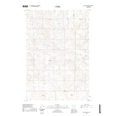
2020 Map of Miller Creek NW
USGS Topo · Published 2020About this map
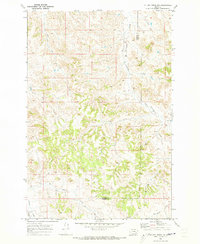
Graveyard Creek and its neighboring drainages shape this landscape along the border of Rosebud and Custer Counties. The terrain is defined by a dense network of intermittent watercourses, including Iron Jaw Creek, Buffalo Creek, and Coal Creek, which have carved out the land to form distinct features like Horton Hollow. This part of Montana shows the legacy of the Public Land Survey System, with the map clearly delineating several townships including t5n r44e and t6n r45e. Human activity is concentrated along sparse rural corridors such as Graveyard Creek Road and Rd 607. The hydrology labels, some referencing data dating back to 1899, reveal a landscape where water management and seasonal flows dictate the layout of the high plains, providing a detailed record for those studying the physical geography and ranching boundaries of the region.
Find a feature on this map
16 named features on this map. Tap any name to fly to it.
Don’t see what you’re looking for? This feature index may not catch every label — zoom into the map to look around manually.
Map Details
Editions of this 2020 Miller Creek NW Map
This is the sole edition of this map. No revisions or reprints were ever made.
Other maps of this area

1954 · Forsyth
USGS Topo · 1:250,000

1957 · Forsyth
USGS Topo · 1:250,000

1958 · Forsyth
USGS Topo · 1:250,000

1968 · Hathaway
USGS Topo · 1:24,000

1968 · Horton
USGS Topo · 1:24,000

1968 · Thurlow
USGS Topo · 1:24,000
1969 · Moon Creek School
USGS Topo · 1:24,000
1969 · Miller Creek
USGS Topo · 1:24,000
1969 · Miller Creek SW
USGS Topo · 1:24,000
1969 · Miller Creek NW
USGS Topo · 1:24,000