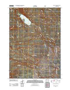
2011 Map of Miller Lake
USGS Topo · Published 2011About this map
Miller Lake serves as the central focal point of this Cascade Range landscape in Douglas County. The shoreline is home to the Digit Point Trailhead, providing a primary point of access for the network of forest roads and trails that traverse the area. The terrain is defined by volcanic features like Adell Butte to the north and Red Cone to the west, with numerous drainages including Evening Creek and Tipsoo Creek feeding into the lake basin.
Find a feature on this map
20 named features on this map. Tap any name to fly to it.
Don’t see what you’re looking for? This feature index may not catch every label — zoom into the map to look around manually.
Map Details
Editions of this 2011 Miller Lake Map
This is the sole edition of this map. No revisions or reprints were ever made.
Other maps of this area

1917 · Diamond Lake
USGS Topo · 1:125,000

1935 · Chemult
USGS Topo · 1:96,000

1941 · Chemult
USGS Topo · 1:125,000

1955 · Crescent
USGS Topo · 1:250,000

1956 · Diamond Lake
USGS Topo · 1:62,500

1956 · Summit Lake
USGS Topo · 1:62,500

1957 · Crescent
USGS Topo · 1:250,000

1958 · Crescent
USGS Topo · 1:250,000

1958 · Roseburg
USGS Topo · 1:250,000

1959 · Roseburg
USGS Topo · 1:250,000