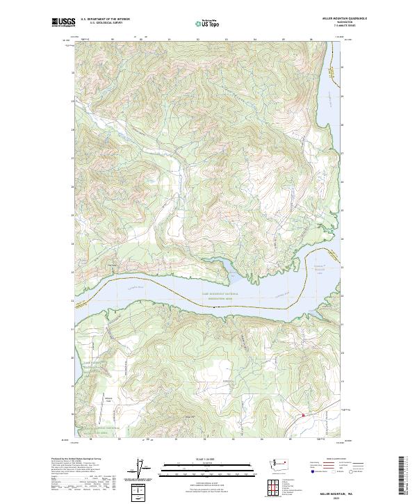
2023 Map of Miller Mountain
USGS Topo · Published 2023About this map
Miller Mtn and the steep terrain of the Grant Canyon define the landscape north of the Columbia River in this 2023 survey. This region, where the river widens into Franklin D Roosevelt Lake, is characterized by rugged breaks and narrow drainages like Corkscrew Canyon and Glasgow Canyon. The presence of the Lake Roosevelt National Recreation Area and various access points such as Wilmont Bay and Gerome Bay highlights the transition from a traditional river valley to a modern reservoir-based geography. Local landmarks, including Whiterik Field and Enterprise Valley, provide essential orientation for those tracing the development and geography along the Ferry and Stevens county line. Forest roads like Wilmont Creek Rd and BIA Rd 1 wind through the hills, connecting dispersed water sources like Mitchell Spring to the river's edge.
Find a feature on this map
37 named features on this map. Tap any name to fly to it.
Don’t see what you’re looking for? This feature index may not catch every label — zoom into the map to look around manually.
Map Details
Editions of this 2023 Miller Mountain Map
This is the sole edition of this map. No revisions or reprints were ever made.
Other maps of this area

1948 · Hunters
USGS Topo · 1:62,500

1948 · Wilmont Creek
USGS Topo · 1:62,500

1948 · Lincoln
USGS Topo · 1:62,500

1948 · Turtle Lake
USGS Topo · 1:62,500

1950 · Lincoln
USGS Topo · 1:62,500

1950 · Turtle Lake
USGS Topo · 1:62,500

1950 · Wilmont Creek
USGS Topo · 1:62,500

1950 · Hunters
USGS Topo · 1:62,500

1953 · Ritzville
USGS Topo · 1:250,000

1954 · Okanogan
USGS Topo · 1:250,000