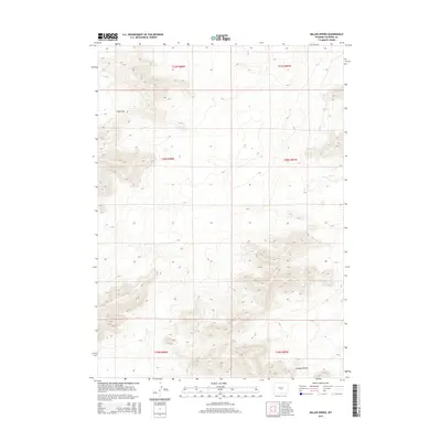
2015 Map of Miller Spring
USGS Topo · Published 2015About this map
Miller Spring serves as a primary water source in this high-elevation landscape of central Wyoming, situated within the complex topography of Natrona County. The terrain is defined by significant natural landmarks such as Wolf Gap in the northwest and Ordway Pocket in the southeast, reflecting a region where land use is dictated by the availability of water and the ruggedness of the earth. Drainages like Dry Cr carve through the sections, illustrating the seasonal nature of the local hydrology. This 2015 survey provides a clear view of the Public Land Survey System grid, including townships t30n r88w and t31n r87w, which organize this open range into a distinct legal geography. The absence of major settlements emphasizes the area's character as a site for ranching or resource management rather than urban development.
Find a feature on this map
10 named features on this map. Tap any name to fly to it.
Don’t see what you’re looking for? This feature index may not catch every label — zoom into the map to look around manually.
Map Details
Editions of this 2015 Miller Spring Map
This is the sole edition of this map. No revisions or reprints were ever made.
Other maps of this area

1951 · Savage Peak
USGS Topo · 1:24,000

1951 · Bucklin Reservoirs
USGS Topo · 1:24,000

1951 · Independence Rock
USGS Topo · 1:24,000

1951 · Lone Mountain
USGS Topo · 1:24,000

1955 · Casper
USGS Topo · 1:250,000

1958 · Casper
USGS Topo · 1:250,000

1959 · Saddle Rock
USGS Topo · 1:24,000

1959 · Miller Spring
USGS Topo · 1:24,000

1959 · Blackjack Ranch
USGS Topo · 1:24,000

1959 · Barlow Gap
USGS Topo · 1:24,000