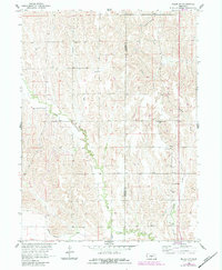
1961 Map of Miller SW
USGS Topo · Published 1984About this map
The boundary between Dawson Co and Buffalo Co defines this central Nebraska landscape, which is characterized by the branching drainage systems of several key waterways. Elm Creek and Turkey Creek cut through the terrain, joined by the smaller flows of Cherry Valley and Bell Creek. In the southern portion of the sheet, the Dawson Co Canal follows the lower elevations, signaling the area's agricultural reliance on water management as part of the Missouri River Basin development program. Local life in the mid-twentieth century is anchored by rural institutions like School No 81 and School No 43, providing specific locations for genealogists tracing family roots in this farming region. The presence of Fairview Cem further grounds the map for those researching the early residents of this borderland area between Dawson and Buffalo counties.
Find a feature on this map
10 named features on this map. Tap any name to fly to it.
Don’t see what you’re looking for? This feature index may not catch every label — zoom into the map to look around manually.
Map Details
Editions of this 1961 Miller SW Map
2 editions found
Other maps of this area

1896 · Lexington
USGS Topo · 1:125,000

1896 · Kearney
USGS Topo · 1:125,000

1899 · Lexington
USGS Topo · 1:125,000

1955 · Grand Island
USGS Topo · 1:250,000

1957 · Grand Island
USGS Topo · 1:250,000

1958 · Grand Island
USGS Topo · 1:250,000

1961 · Elm Creek West
USGS Topo · 1:24,000

1961 · Amherst
USGS Topo · 1:24,000

1961 · Miller SW
USGS Topo · 1:24,000

1962 · Elm Creek East
USGS Topo · 1:24,000