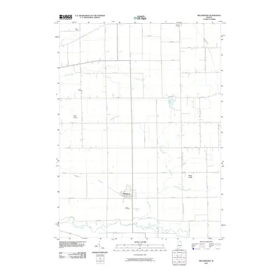
2010 Map of Millersburg
USGS Topo · Published 2010About this map
The Millersburg settlement and its surrounding agricultural landscape are defined by a complex network of natural waterways and drainage infrastructure in this northern Indiana study. The Elkhart River meanders across the southern portion of the quadrangle, while several significant ditches, such as McAllister Ditch, Phillips Ditch, and Rowe-Eden Ditch, indicate a long history of water management to support the region's fertile farmland.
Find a feature on this map
45 named features on this map. Tap any name to fly to it.
Don’t see what you’re looking for? This feature index may not catch every label — zoom into the map to look around manually.
Map Details
Editions of this 2010 Millersburg Map
This is the sole edition of this map. No revisions or reprints were ever made.
Other maps of this area

1951 · Milford
USGS Topo · 1:24,000

1951 · Wawasee
USGS Topo · 1:24,000

1953 · Fort Wayne
USGS Topo · 1:250,000

1956 · Fort Wayne
USGS Topo · 1:250,000

1956 · Ligonier
USGS Topo · 1:24,000

1959 · Topeka
USGS Topo · 1:24,000

1959 · Millersburg
USGS Topo · 1:24,000

1959 · Goshen
USGS Topo · 1:24,000
1961 · Shipshewana
USGS Topo · 1:24,000
1961 · Lake Wawasee
USGS Topo · 1:24,000