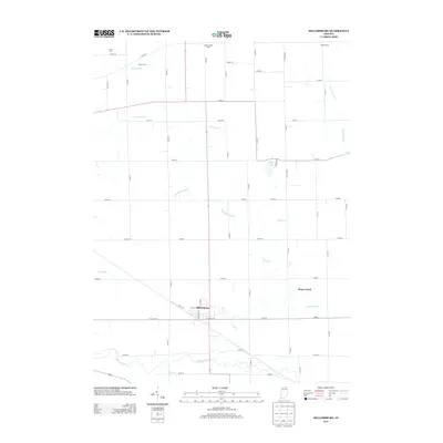
2013 Map of Millersburg
USGS Topo · Published 2013About this map
Millersburg sits at the heart of this Elkhart County landscape, where the town street grid transitions into an extensive network of rural agricultural holdings and drainage systems. The town is anchored by Elm St and Jefferson St, serving as a hub for the surrounding countryside. The map reveals the intricate management of the local watershed, defined by numerous named drainage features such as Boyer Ditch, McAllister Ditch, and Phillips Ditch that feed into Stony Creek and the Elkhart River. Several prominent local estates and farming operations are identified by name, including Maplebranch Farm, Ladon Farms, and Miller Farms, reflecting the area's enduring agrarian character. To the north, the small residential area of Loyal Acres sits tucked away near the county line, while Fish Lake provides a natural landmark amidst the surveyed road network.
Find a feature on this map
55 named features on this map. Tap any name to fly to it.
Don’t see what you’re looking for? This feature index may not catch every label — zoom into the map to look around manually.
Map Details
Editions of this 2013 Millersburg Map
This is the sole edition of this map. No revisions or reprints were ever made.
Other maps of this area

1951 · Milford
USGS Topo · 1:24,000

1951 · Wawasee
USGS Topo · 1:24,000

1953 · Fort Wayne
USGS Topo · 1:250,000

1956 · Fort Wayne
USGS Topo · 1:250,000

1956 · Ligonier
USGS Topo · 1:24,000

1959 · Topeka
USGS Topo · 1:24,000

1959 · Millersburg
USGS Topo · 1:24,000

1959 · Goshen
USGS Topo · 1:24,000
1961 · Shipshewana
USGS Topo · 1:24,000
1961 · Lake Wawasee
USGS Topo · 1:24,000