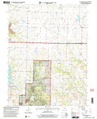
2000 Map of Millersburg NE
USGS Topo · Published 2003About this map
Mark Twain National Forest dominates the central and southern reaches of this landscape, where the wooded terrain meets the open expanses of the Grand Prairie. This transition between forest and prairie is marked by the headwaters of several drainages, including Auxvasse Creek, Stinson Creek, and the Middle River. Settlement patterns are defined by small crossroads like Hereford, Eastville, and Millersburg, each serving as anchors for rural life centered around local institutions. Cultural history is preserved in several country churches and burial grounds, such as Rising Sun Ch and the New Richland Ch Cem. To the west, the Little Dixie Lake State Wildlife Management Area and its associated Fish Hatchery highlight the area's focus on conservation, while the presence of Strip Mines in the southwest corner points to a history of resource extraction alongside the agricultural landscape.
Find a feature on this map
29 named features on this map. Tap any name to fly to it.
Don’t see what you’re looking for? This feature index may not catch every label — zoom into the map to look around manually.
Map Details
Editions of this 2000 Millersburg NE Map
This is the sole edition of this map. No revisions or reprints were ever made.
Other maps of this area

1886 · Jefferson City
USGS Topo · 1:125,000

1890 · Mexico
USGS Topo · 1:125,000

1890 · Moberly
USGS Topo · 1:125,000

1890 · Fulton
USGS Topo · 1:125,000

1894 · Jefferson City
USGS Topo · 1:125,000

1928 · Fulton
USGS Topo · 1:62,500

1931 · Fulton
USGS Topo · 1:62,500

1932 · Mexico
USGS Topo · 1:62,500

1944 · Millersburg
USGS Topo · 1:62,500

1945 · Centralia
USGS Topo · 1:62,500