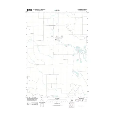
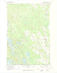
2011 Map of Millersburg
USGS Topo · Published 2011About this map
The Ocqueoc River winds through the heart of Case Township, anchoring the village of Millersburg. This 2011 survey reveals a landscape defined by its glacial hydrology, with a dense network of water bodies including Mcintosh Lake, Gorman Lakes, and the Upper and Lower Barnhart Lake systems. The settlement pattern remains centered on the river crossing, where the Millersburg Post Office and the Presque Isle County Fairgrounds serve as local landmarks.
Find a feature on this map
60 named features on this map. Tap any name to fly to it.
Don’t see what you’re looking for? This feature index may not catch every label — zoom into the map to look around manually.
Map Details
Editions of this 2011 Millersburg Map
This is the sole edition of this map. No revisions or reprints were ever made.
Other maps of this area
1954 · Alpena
USGS Topo · 1:250,000
1955 · Atlanta
USGS Topo · 1:62,500
1955 · Hillman
USGS Topo · 1:62,500

1955 · Cheboygan
USGS Topo · 1:250,000
1957 · Alpena
USGS Topo · 1:250,000
1957 · Onaway
USGS Topo · 1:62,500

1958 · Cheboygan
USGS Topo · 1:250,000
1958 · Alpena
USGS Topo · 1:250,000
1969 · Alpena
USGS Topo · 1:250,000
1971 · Hawks
USGS Topo · 1:24,000