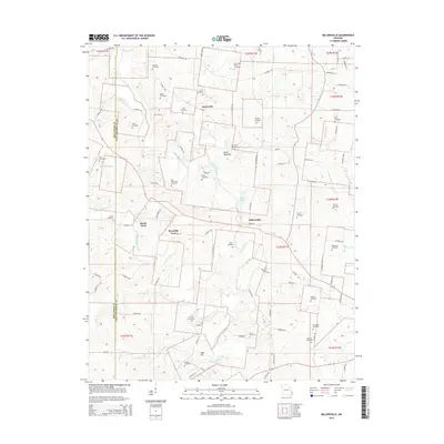
2015 Map of Millersville
USGS Topo · Published 2015About this map
Millersville and Kurreville anchor this Cape Girardeau County landscape, where the meandering course of Upper Whitewater Creek and its many tributaries define the local geography. The map reveals a dense network of family-named landmarks and rural burial grounds, such as the Gladish Cemetery, Slinkard Cemetery, and Herzinger Cemetery, which offer significant value for genealogical research in this part of Missouri. The terrain is marked by distinctive elevations like Devils Backbone and Cave Hill, situated between the waterways of Caney Fork and Schroder Br. Notable river crossings including Hartle Ford and Reynolds Ford illustrate the historic transit patterns along the creeks before modern bridges dominated the region. Small-scale infrastructure like the Prince Airport and Cedar Lake further highlight the varied land use across this rural quadrangle.
Find a feature on this map
97 named features on this map. Tap any name to fly to it.
Don’t see what you’re looking for? This feature index may not catch every label — zoom into the map to look around manually.
Map Details
Editions of this 2015 Millersville Map
This is the sole edition of this map. No revisions or reprints were ever made.
Other maps of this area

1918 · Altenburg
USGS Topo · 1:62,500

1922 · Cape Girardeau
USGS Topo · 1:62,500

1923 · Perryville
USGS Topo · 1:62,500

1924 · Cape Girardeau
USGS Topo · 1:62,500

1924 · Perryville
USGS Topo · 1:62,500

1925 · Altenburg
USGS Topo · 1:62,500

1933 · Marble Hill
USGS Topo · 1:62,500

1937 · Marble Hill
USGS Topo · 1:62,500

1947 · Oak Ridge
USGS Topo · 1:24,000

1947 · Altenburg
USGS Topo · 1:62,500