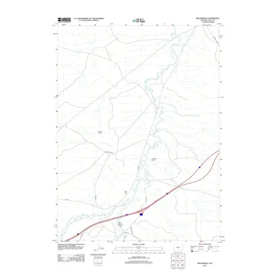
2012 Map of Millersville
USGS Topo · Published 2012About this map
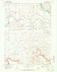
Blacks Fork meanders through this landscape, defining the topography alongside the drainage of Smiths Fork. The area is characterized by significant natural depressions and cuts, such as Jackknife Draw and Moss Agate Cut, which speak to the complex hydrology and geological formations of this part of Uinta County. Modern transportation corridors are established along historical routes, evidenced by the presence of Eakin Station Rd and Church Butte Rd, which connect the scattered rural features. These roads often parallel or intersect the natural washes like Austin Wash, illustrating the intersection of human transit and the high-desert terrain. Local landmarks such as Mud Spring Hollow and the pathway of Hank Hollow Rd provide specific reference points for researchers interested in the rural development and land-use patterns of the early 21st century.
Find a feature on this map
14 named features on this map. Tap any name to fly to it.
Don’t see what you’re looking for? This feature index may not catch every label — zoom into the map to look around manually.
Map Details
Editions of this 2012 Millersville Map
This is the sole edition of this map. No revisions or reprints were ever made.
Other maps of this area

1954 · Ogden
USGS Topo · 1:250,000

1958 · Ogden
USGS Topo · 1:250,000

1960 · Ogden
USGS Topo · 1:250,000

1964 · Butcher Knife Draw
USGS Topo · 1:24,000

1964 · Mountain View
USGS Topo · 1:24,000
1964 · Wildcat Butte
USGS Topo · 1:24,000

1964 · Austin Reservoir
USGS Topo · 1:24,000
1965 · Millersville
USGS Topo · 1:24,000
1965 · Turtle Hill
USGS Topo · 1:24,000
1969 · Verne
USGS Topo · 1:24,000