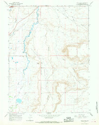
1965 Map of Turtle Hill
USGS Topo · Published 1968About this map
Emigrant Trail tracks through the northwestern corner of this landscape, marking a historical corridor of westward movement through Uinta County. The terrain is defined by the high, flat expanse of the Cottonwood Bench, which sits between the winding path of Smiths Fork and the drainage of Cottonwood Creek. The agricultural development of the region is evident through an intricate network of irrigation systems, including the Lyman Canal and Urie Ditch, which divert water to sustain ranching on the arid plains. Notable landmarks like Turtle Hill and Emigrant Draw provide distinct reference points for researchers tracing old travel routes or family land holdings. The presence of Hank Road and various unnamed tracks suggests a pattern of land use centered on the seasonal movement of livestock and water management in this high-desert environment.
Find a feature on this map
18 named features on this map. Tap any name to fly to it.
Don’t see what you’re looking for? This feature index may not catch every label — zoom into the map to look around manually.
Map Details
Editions of this 1965 Turtle Hill Map
2 editions found
Other maps of this area

1954 · Ogden
USGS Topo · 1:250,000

1958 · Ogden
USGS Topo · 1:250,000

1960 · Ogden
USGS Topo · 1:250,000

1964 · Butcher Knife Draw
USGS Topo · 1:24,000

1964 · Soap Holes Reservoir
USGS Topo · 1:24,000

1964 · Reed Reservoir
USGS Topo · 1:24,000

1964 · Mountain View
USGS Topo · 1:24,000
1964 · Wildcat Butte
USGS Topo · 1:24,000

1964 · Austin Reservoir
USGS Topo · 1:24,000
1964 · Leavitt Bench
USGS Topo · 1:24,000