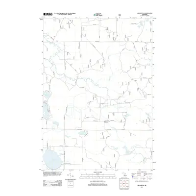
2012 Map of Millerton
USGS Topo · Published 2012About this map
The Big Sable River and Little Sable River dominate this Mason County landscape, winding through a region characterized by numerous glacial water bodies. The small settlement of Millerton serves as a central point, marked by its Po (post office) at the junction of Millerton Rd and Landon Rd. This 2012 survey illustrates the rural nature of Sheridan Township, where isolated educational sites like the Round Lake School sit near the shores of Round Lake. The map reveals an intricate network of forest and county roads, such as Freesoil Rd and Elk Hwy, providing access to various fishing and recreational spots like Ford Lake, Thunder Lake, and the marshy edges of Cranberry Lake. This modern topographic record is essential for understanding the contemporary hydrology and access points within these northern Michigan wetlands and river valleys.
Find a feature on this map
65 named features on this map. Tap any name to fly to it.
Don’t see what you’re looking for? This feature index may not catch every label — zoom into the map to look around manually.
Map Details
Editions of this 2012 Millerton Map
This is the sole edition of this map. No revisions or reprints were ever made.
Other maps of this area

1931 · Custer NW
USGS Topo · 1:31,680

1931 · Baldwin NW
USGS Topo · 1:31,680

1931 · Custer NE
USGS Topo · 1:31,680

1931 · Freesoil SW
USGS Topo · 1:31,680

1932 · Freesoil SE
USGS Topo · 1:31,680

1933 · Peacock SW
USGS Topo · 1:31,680

1933 · Peacock NW
USGS Topo · 1:31,680

1954 · Traverse City
USGS Topo · 1:250,000

1954 · Milwaukee
USGS Topo · 1:250,000

1954 · Midland
USGS Topo · 1:250,000