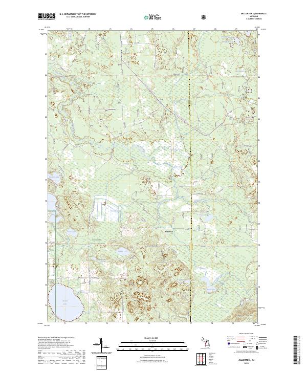
2023 Map of Millerton
USGS Topo · Published 2023About this map
Millerton sits at the intersection of rural transit and natural conservation, marking a small pocket of settlement within the expansive Manistee National Forest. This landscape is defined by its complex hydrology, where the Big Sable River and Little Sable River wind through a terrain punctuated by numerous named basins, including Ford Lake and Cunningham Lake. The boundary between Mason Co and Lake Co bisects the eastern portion of the map, revealing how political lines traverse the wooded wetlands of the Ward Hills region.
Find a feature on this map
64 named features on this map. Tap any name to fly to it.
Don’t see what you’re looking for? This feature index may not catch every label — zoom into the map to look around manually.
Map Details
Editions of this 2023 Millerton Map
This is the sole edition of this map. No revisions or reprints were ever made.
Other maps of this area

1931 · Custer NW
USGS Topo · 1:31,680

1931 · Baldwin NW
USGS Topo · 1:31,680

1931 · Custer NE
USGS Topo · 1:31,680

1931 · Freesoil SW
USGS Topo · 1:31,680

1932 · Freesoil SE
USGS Topo · 1:31,680

1933 · Peacock SW
USGS Topo · 1:31,680

1933 · Peacock NW
USGS Topo · 1:31,680

1954 · Traverse City
USGS Topo · 1:250,000

1954 · Milwaukee
USGS Topo · 1:250,000

1954 · Midland
USGS Topo · 1:250,000