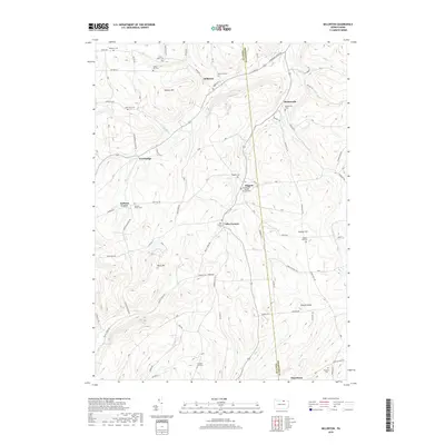
2019 Map of Millerton
USGS Topo · Published 2019About this map
Millerton and Mosherville anchor this portion of the Pennsylvania-New York borderlands, where the terrain transitions from the high ridges of Norway Hill and Buck Mtn toward the creek valleys. The map reveals a deeply rooted rural landscape defined by small clusters like Daggett, Jobs Corners, and Jackson Center. This area is particularly notable for its dense concentration of small family and community burial grounds, such as the Old Daggett Burial Ground Cem and the Jacob Miller Cem, which suggest generations of agricultural settlement. Winding roads like Hammond Creek Rd and Coryland Rd follow the natural topography, connecting these upland communities. Waterways including Alder Run and Bear Cr drain the higher elevations, carving out the valleys that dictated the placement of early homes and farmsteads. The persistence of these small place names and cemeteries provides a clear record of the region's enduring rural character.
Find a feature on this map
92 named features on this map. Tap any name to fly to it.
Don’t see what you’re looking for? This feature index may not catch every label — zoom into the map to look around manually.
Map Details
Editions of this 2019 Millerton Map
This is the sole edition of this map. No revisions or reprints were ever made.
Other maps of this area

1895 · Elmira
USGS Topo · 1:62,500

1900 · Tioga
USGS Topo · 1:62,500

1902 · Tioga
USGS Topo · 1:62,500

1905 · Watkins Glen
USGS Topo · 1:125,000

1914 · Corning
USGS Topo · 1:62,500

1931 · Troy
USGS Topo · 1:48,000

1938 · Troy
USGS Topo · 1:62,500

1944 · Corning
USGS Topo · 1:62,500

1950 · Elmira
USGS Topo · 1:250,000

1953 · Roseville
USGS Topo · 1:24,000
Featured Places
- Columbia Township, PA
- Jackson Township, PA
- Daggett, Jackson Township
- Jobs Corners, Jackson Township
- Millerton, Jackson Township