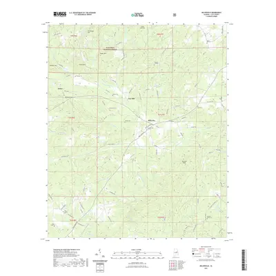
2021 Map of Millerville
USGS Topo · Published 2021About this map
Millerville sits at the heart of this Clay County landscape, where the foothills of the southern Appalachians are defined by high points like Hillabee Ridge and Poe Bridge Mtn. Much of the northwest corner is protected within the Talladega National Forest, a terrain of dense contours and drainage systems feeding into Little Hillabee Creek and its many tributaries, including Charles Br and Blue Cr.
Find a feature on this map
100 named features on this map. Tap any name to fly to it.
Don’t see what you’re looking for? This feature index may not catch every label — zoom into the map to look around manually.
Map Details
Editions of this 2021 Millerville Map
This is the sole edition of this map. No revisions or reprints were ever made.
Other maps of this area

1890 · Talladega
USGS Topo · 1:125,000

1891 · Ashland
USGS Topo · 1:125,000

1892 · Talladega
USGS Topo · 1:125,000

1943 · Talladega
USGS Topo · 1:62,500

1944 · Goodwater
USGS Topo · 1:62,500

1946 · Talladega
USGS Topo · 1:62,500

1947 · Goodwater
USGS Topo · 1:62,500

1953 · Birmingham
USGS Topo · 1:250,000

1953 · Atlanta
USGS Topo · 1:250,000

1956 · Birmingham
USGS Topo · 1:250,000