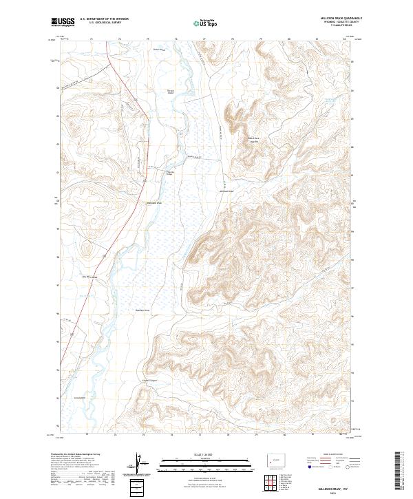
2021 Map of Milleson Draw
USGS Topo · Published 2021About this map
The Green River meanders through this landscape, creating a complex system of islands and irrigation channels essential to Sublette County agriculture. Distinctive water management features like the Highline Canal, Whitewater Ditch, and Green River Island Ditch illustrate the engineering required to sustain ranching in the high basin. Near Fivemile Bridge, the river splits to form Tarters Island, while seasonal drainages such as Dry Piney Cr and Milleson Draw carve into the surrounding uplands.
Find a feature on this map
29 named features on this map. Tap any name to fly to it.
Don’t see what you’re looking for? This feature index may not catch every label — zoom into the map to look around manually.
Map Details
Editions of this 2021 Milleson Draw Map
This is the sole edition of this map. No revisions or reprints were ever made.
Other maps of this area

1939 · Big Piney
USGS Topo · 1:125,000

1942 · Big Piney
USGS Topo · 1:125,000

1955 · Preston
USGS Topo · 1:250,000

1955 · Lander
USGS Topo · 1:250,000

1958 · Lander
USGS Topo · 1:250,000

1958 · Preston
USGS Topo · 1:250,000

1961 · Lander
USGS Topo · 1:250,000

1962 · Preston
USGS Topo · 1:250,000

1964 · Ross Butte
USGS Topo · 1:24,000

1969 · Oasis Well
USGS Topo · 1:24,000