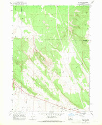
1967 Map of Millican
USGS Topo · Published 1969About this map
Millican sits within the high desert landscape of central Oregon, serving as a focal point in the expansive Millican Valley. This 1967 field-checked survey reveals a territory defined by volcanic geography and the practical infrastructure of rural ranching and resource extraction. The prominence of the Bear Creek Buttes and West Butte dominates the eastern horizon, while the drainage of Smith Canyon and the seasonal path of Dry River carve through the terrain. A complex network of jeep trails connects isolated points of interest, including Coyote Well and a Landing Strip near the townsite. The presence of several industrial sites, such as a Cinder Pit, Borrow Pits, and a Gravel Pit, indicates the local importance of aggregate mining for road building and regional development during the mid-20th century.
Find a feature on this map
17 named features on this map. Tap any name to fly to it.
Don’t see what you’re looking for? This feature index may not catch every label — zoom into the map to look around manually.
Map Details
Editions of this 1967 Millican Map
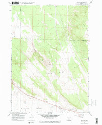
2 editions found
Other maps of this area

1926 · Bend
USGS Topo · 1:125,000

1929 · Bend
USGS Topo · 1:125,000

1931 · Newberry Crater
USGS Topo · 1:125,000

1935 · Newberry Crater
USGS Topo · 1:125,000

1955 · Crescent
USGS Topo · 1:250,000

1955 · Bend
USGS Topo · 1:250,000

1957 · Crescent
USGS Topo · 1:250,000

1957 · Bend
USGS Topo · 1:250,000

1958 · Crescent
USGS Topo · 1:250,000

1958 · Bend
USGS Topo · 1:250,000