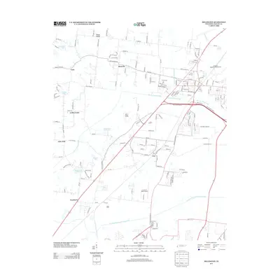
2013 Map of Millington
USGS Topo · Published 2013About this map
Millington Regional Jetport Airport and Charles W. Baker Airport anchor the aviation-heavy landscape of northern Shelby County. This area north of Memphis shows a mix of suburban development and rural legacies, with small communities like Sloanville, West Union, and Griffin Corner distributed along the grid of county roads. The landscape is heavily defined by mid-century water management infrastructure, including the Big Creek Drainage Canal and the Loosahatchie River Drainage Canal, which channel the region's tributaries toward the Mississippi. Agricultural roots persist at Bland Farms and Jones Orchard, while water bodies such as Mitchell Lake Number One and Williams Lake offer pockets of recreation amid the expanding residential tracts. The map details the transition from rural crossroads like Cuba to the industrial and logistical hubs that support the regional economy in the modern era.
Find a feature on this map
164 named features on this map. Tap any name to fly to it.
Don’t see what you’re looking for? This feature index may not catch every label — zoom into the map to look around manually.
Map Details
Editions of this 2013 Millington Map
This is the sole edition of this map. No revisions or reprints were ever made.
Other maps of this area

1916 · Memphis
USGS Topo · 1:62,500

1925 · Memphis
USGS Topo · 1:48,000

1927 · Memphis
USGS Topo · 1:62,500

1931 · Jericho
USGS Topo · 1:62,500

1939 · Jericho
USGS Topo · 1:62,500

1939 · Memphis
USGS Topo · 1:62,500

1942 · Millington
USGS Topo · 1:62,500

1952 · Jericho
USGS Topo · 1:62,500

1953 · Memphis
USGS Topo · 1:250,000

1955 · Memphis
USGS Topo · 1:62,500