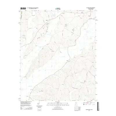
2014 Map of Millport NW
USGS Topo · Published 2014About this map
The northwest corner of Lamar County, Alabama, is defined by its intricate network of creeks and small family-named settlements. The town of Vernon sits in the northeast, where Yellow Creek Rd and Al-18 meet near Furnace Hill Cem. To the southwest, the community of Star and the hamlet of Molloy are situated among the headwaters and tributaries of Yellow Cr and Wilson Cr. The landscape is notably dense with family and community burial grounds, such as Mt Pleasant Cem, Sailor Cem, and the dual sites of Asbury Cem and Old Asbury Cem in the southern reaches. This modern survey reflects a region where traditional land use and drainage patterns, including the engineered Stillman Ditch, continue to shape the local geography alongside established country roads like Academy Rd and Convalescent Rd.
Find a feature on this map
82 named features on this map. Tap any name to fly to it.
Don’t see what you’re looking for? This feature index may not catch every label — zoom into the map to look around manually.
Map Details
Editions of this 2014 Millport NW Map
This is the sole edition of this map. No revisions or reprints were ever made.
Other maps of this area

1953 · West Point
USGS Topo · 1:250,000

1958 · West Point
USGS Topo · 1:250,000

1960 · Caledonia
USGS Topo · 1:62,500

1963 · West Point
USGS Topo · 1:250,000

1966 · Amory SE
USGS Topo · 1:24,000

1967 · Hightogy
USGS Topo · 1:24,000

1967 · Millport
USGS Topo · 1:24,000

1967 · Sulligent SW
USGS Topo · 1:24,000

1967 · Millport NW
USGS Topo · 1:24,000

1967 · Fernbank
USGS Topo · 1:24,000